Apr 19th, 2017
Author: donich_admin
Big Day on Ben Nevis
Ever since R and I started climbing a couple of years ago – my dream has been to climb Ben Nevis – not using the normal “Tourist Route” (which basically involves several hours of walking up a steep man made path in the company of other people) but via the Carn Mor Dearg (CMD) Arete (this is the detail of the route Walk Highlands). Basically this one isn’t for the unfit, inexperienced or faint hearted, because it involves the lengthy traverse of the ridge to another Munro – Carn Mor Dearg (“Big Red Hill”) and then along another ridge to the summit of the big Ben itself.
I’ll point out at this stage that R is not fond of heights – so it was exceedingly nice of him to come with me.
We got up at five and left at six. The weather here was lovely and was supposed to be great in Glen Coe as well. As a good omen, we saw a beautiful red deer stag with massive antlers in a field not far from the house. We got to the Nevis visitor centre at 8am – the weather wasn’t bad, but not as good as at home.
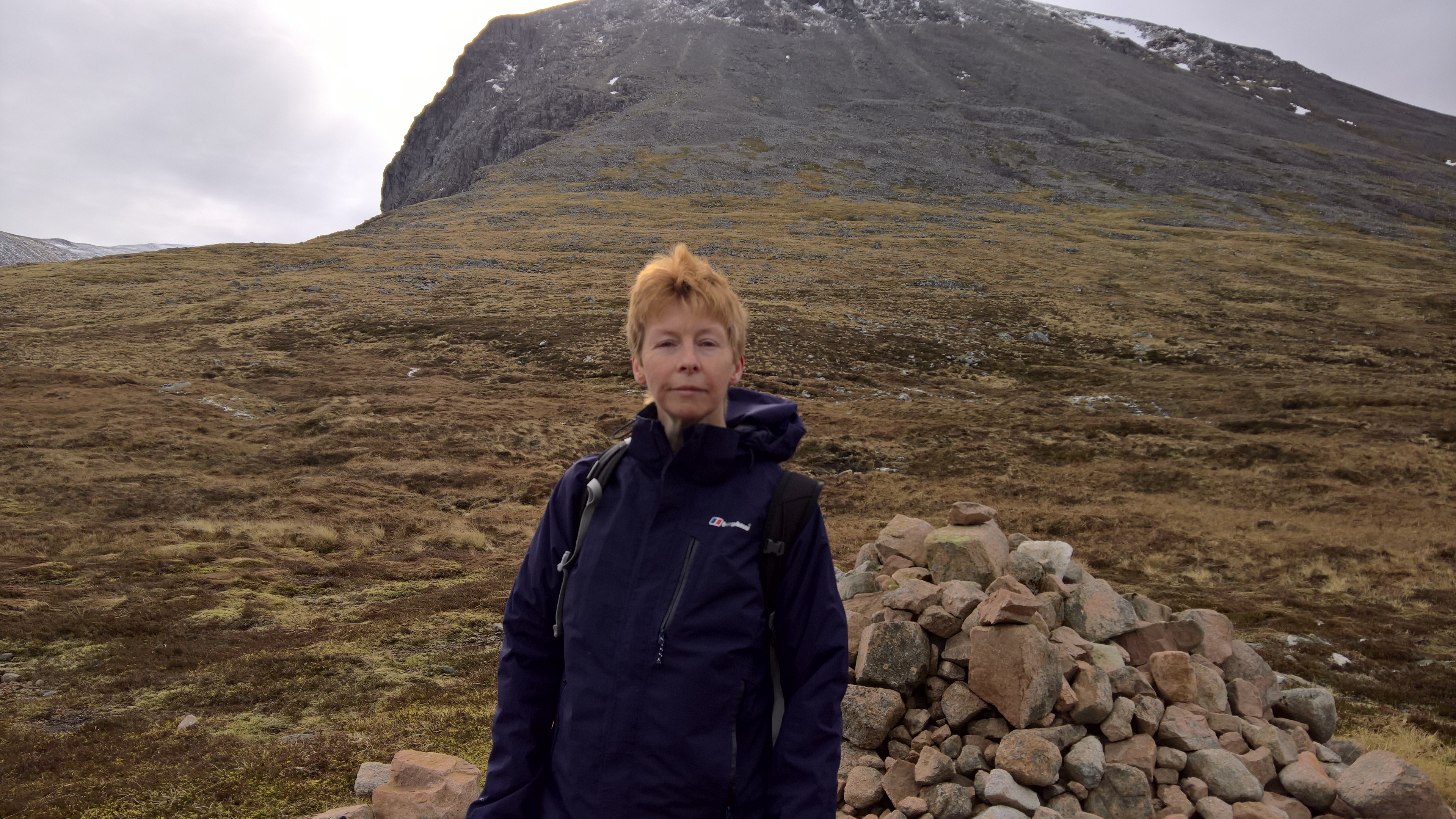
This is me just starting the ascent.

We decided to follow the tourist route for the first 3 miles and then branch off on a side path and ford a burn. The route we were following (which had been put on View Ranger by BBC Countryfile) then had us going 600m straight up to the CMD, but when we got to it – we didn’t like the look of it. Basically it looked as though the person who wrote the route had drawn a straight line on a map without taking into account the fact that the ascent was not only almost sheer vertically, but also crossed a lot of dodgy-looking scree. So we turned left and crossed the lower slope at an angle to meet the Walk Highlands route (which we should perhaps have chosen in the first place) much lower down. This cost us about 300m of ascent but was much easier and safer.
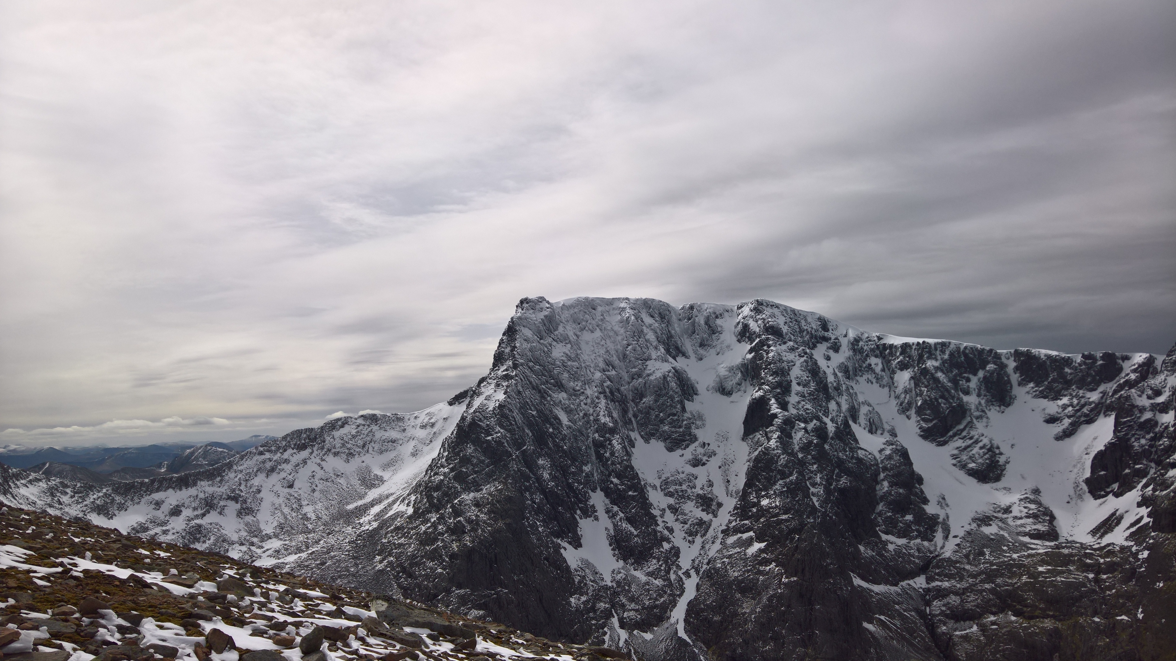
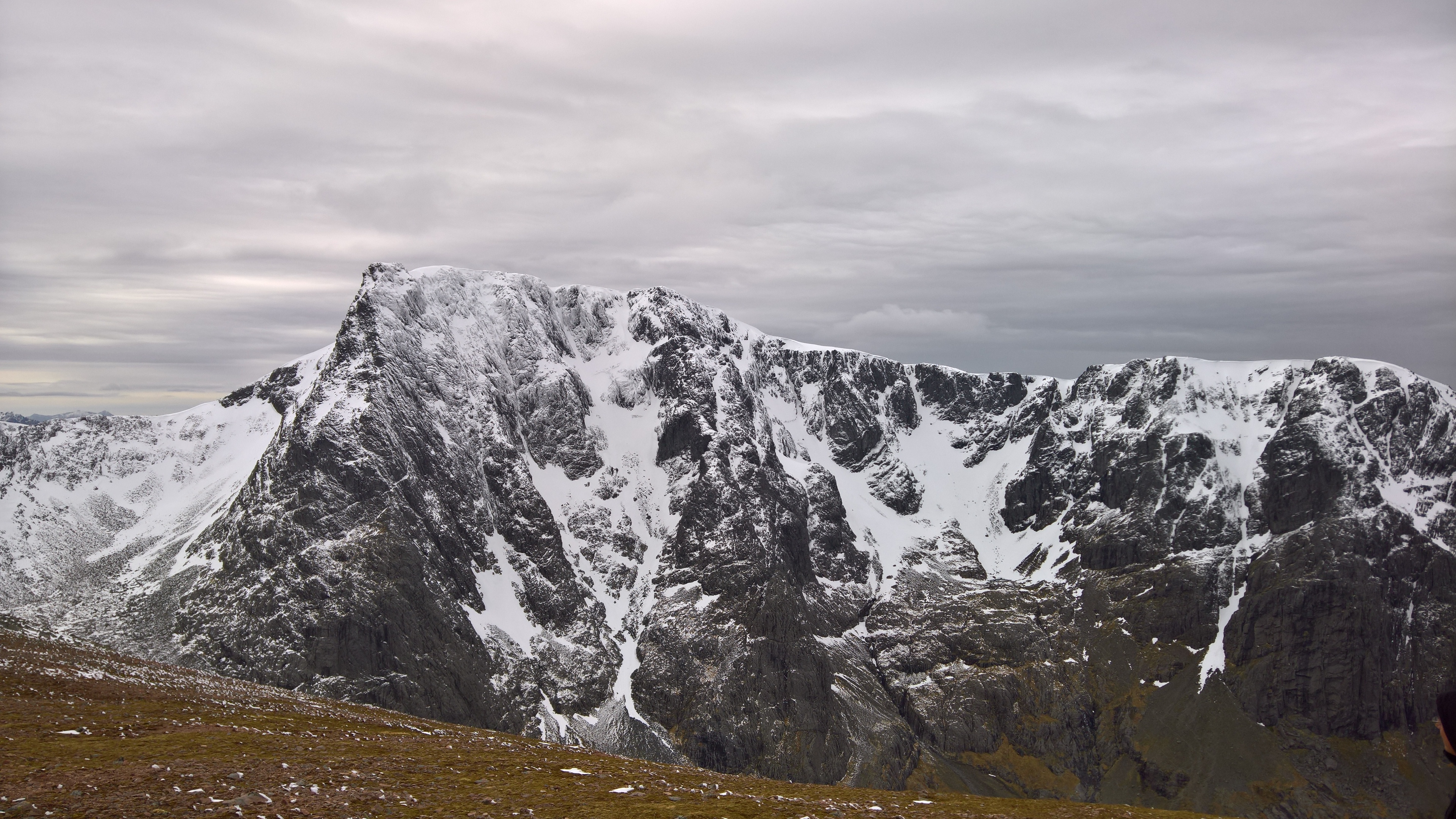
There were some great views back to Fort William and of the (rock climbers only) north face of Ben Nevis.

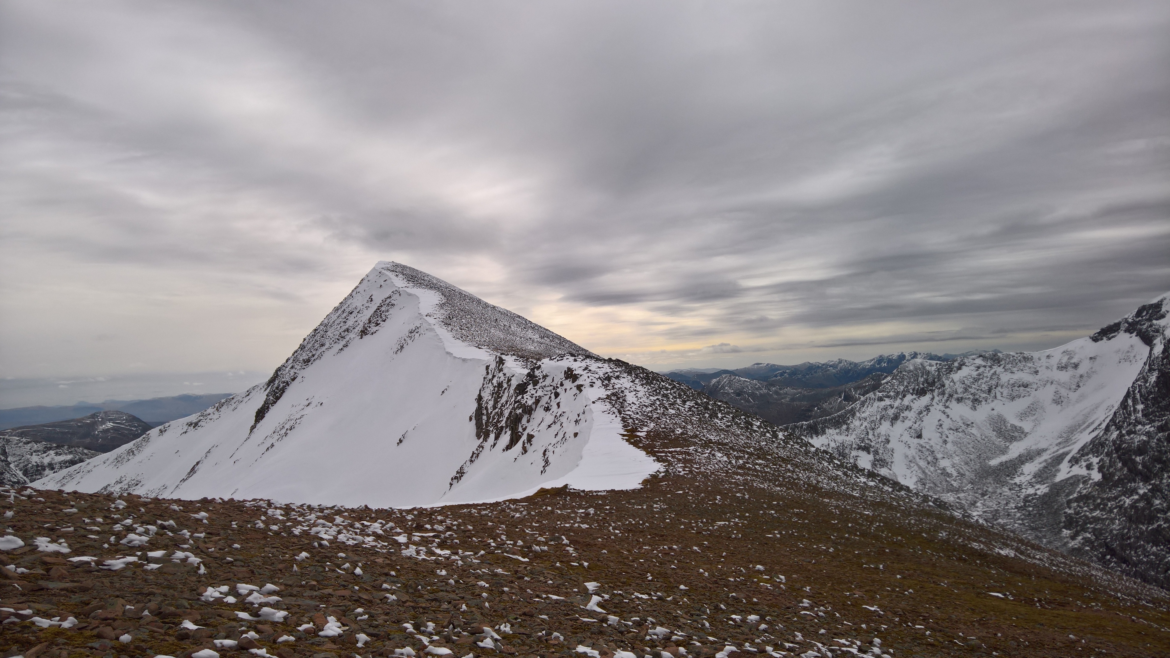
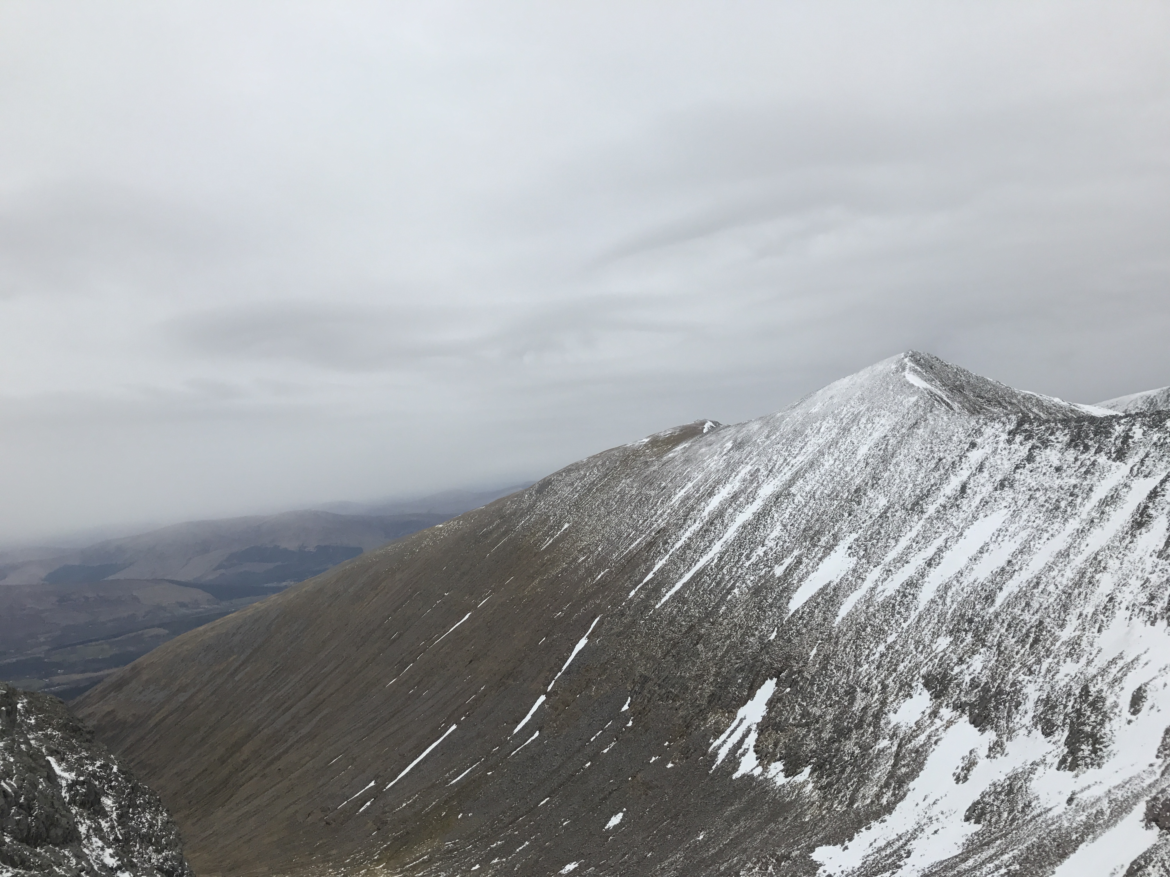
Ahead we could see the ascent to the peak of CMD
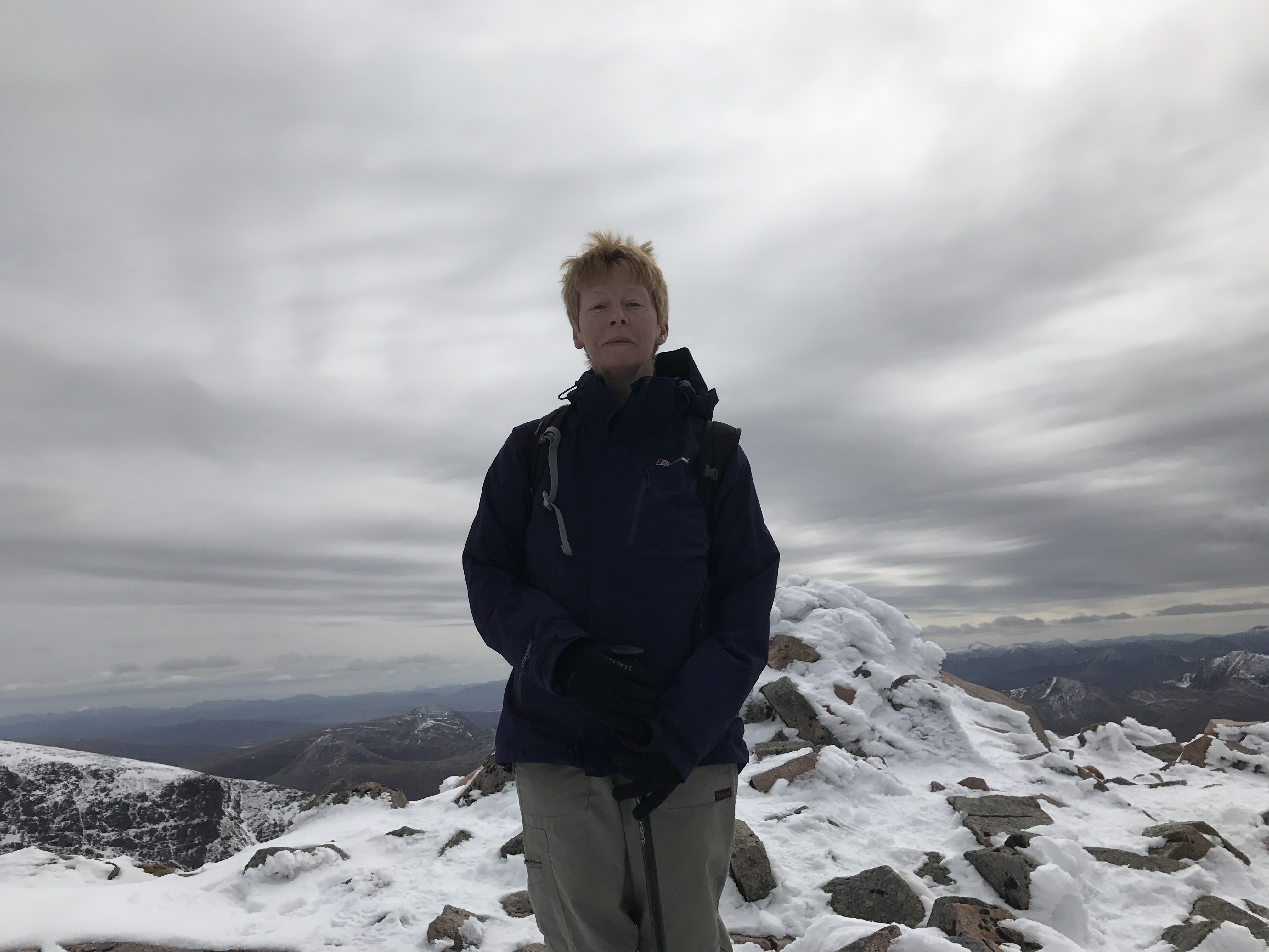
At this point, the ridge was relatively wide and smooth – there is supposed to be a bypass path lower down which saves your head for heights by keeping you off the top, but on this occasion we couldn’t see it for the snow – so the top it was. This is me at the summit.
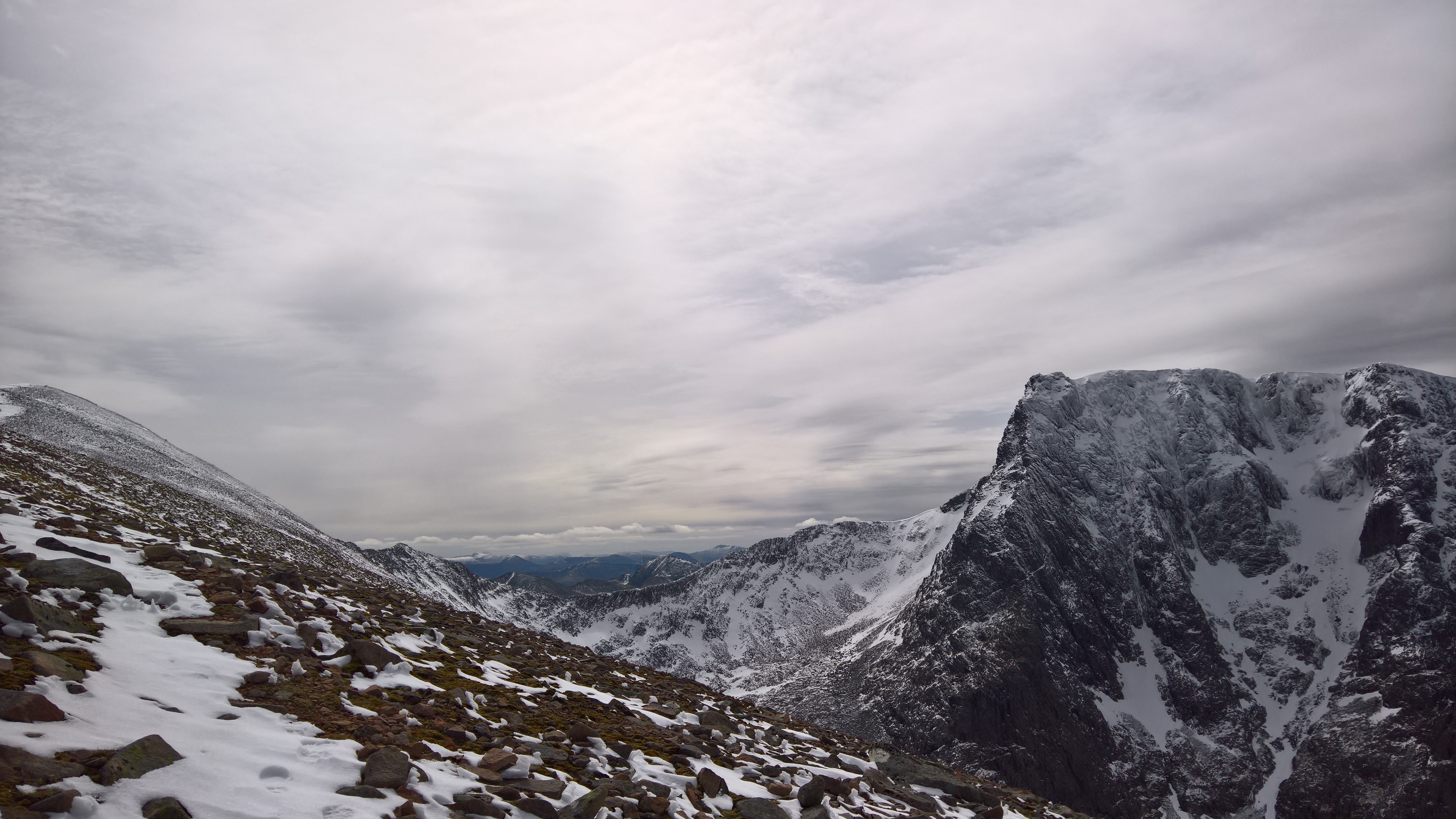
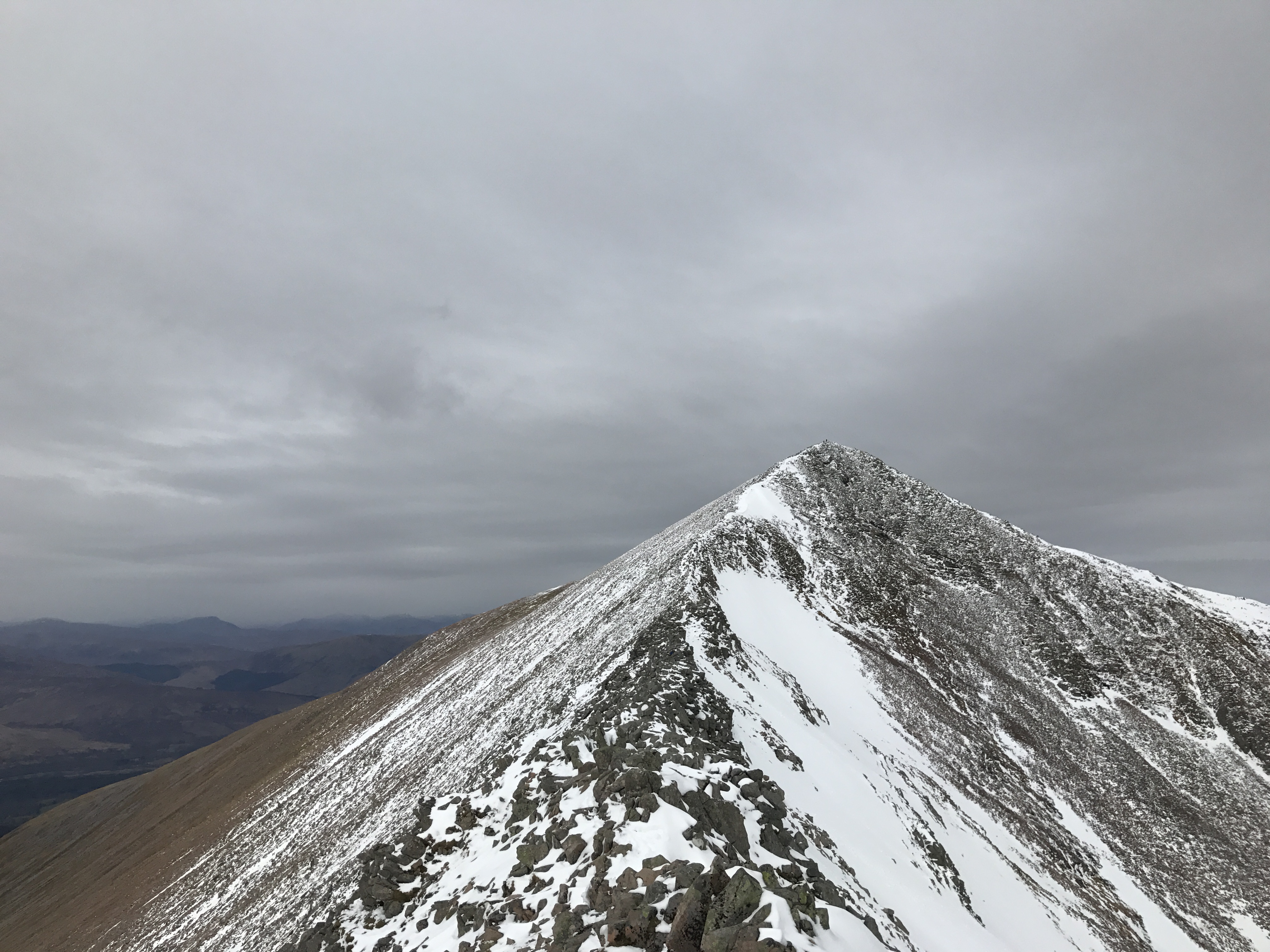
After this, you go on to the Arete proper. It was a bit narrower than I had expected, and there was quite a lot of scrambling over boulders – mildly hair-raising with a big drop to either side.
For reasons which are perhaps obvious, we didn’t take any photos standing on the ridge itself! We got about 3/4 of the way round, and way past the point of no return when the skies started to darken, and a few flakes of snow began to fall, so we motored on as quickly as we could without taking any risks. Luckily we got to the end of the Arete before the snow started properly, which it promptly did just as we reached the base of the final 350m ascent to the summit.

The going here was actually pretty difficult because the snow was quite deep. Luckily a few people had been there before us so there were deep footprints, plus a few snow poles to show the way. We were quite relieved to poke our heads over onto the plateau and see other people – the whole rest of the way we had only seen two others.
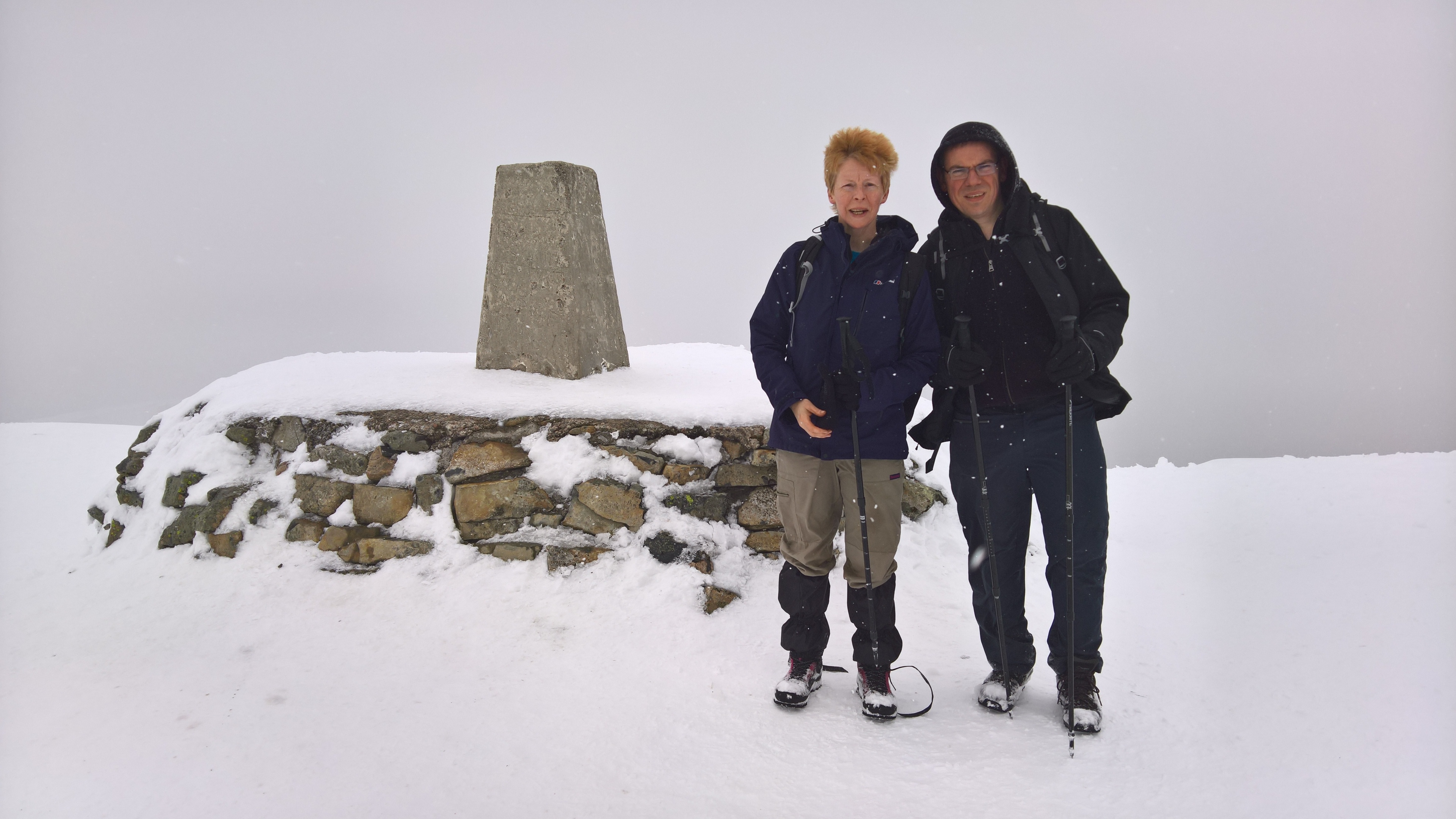
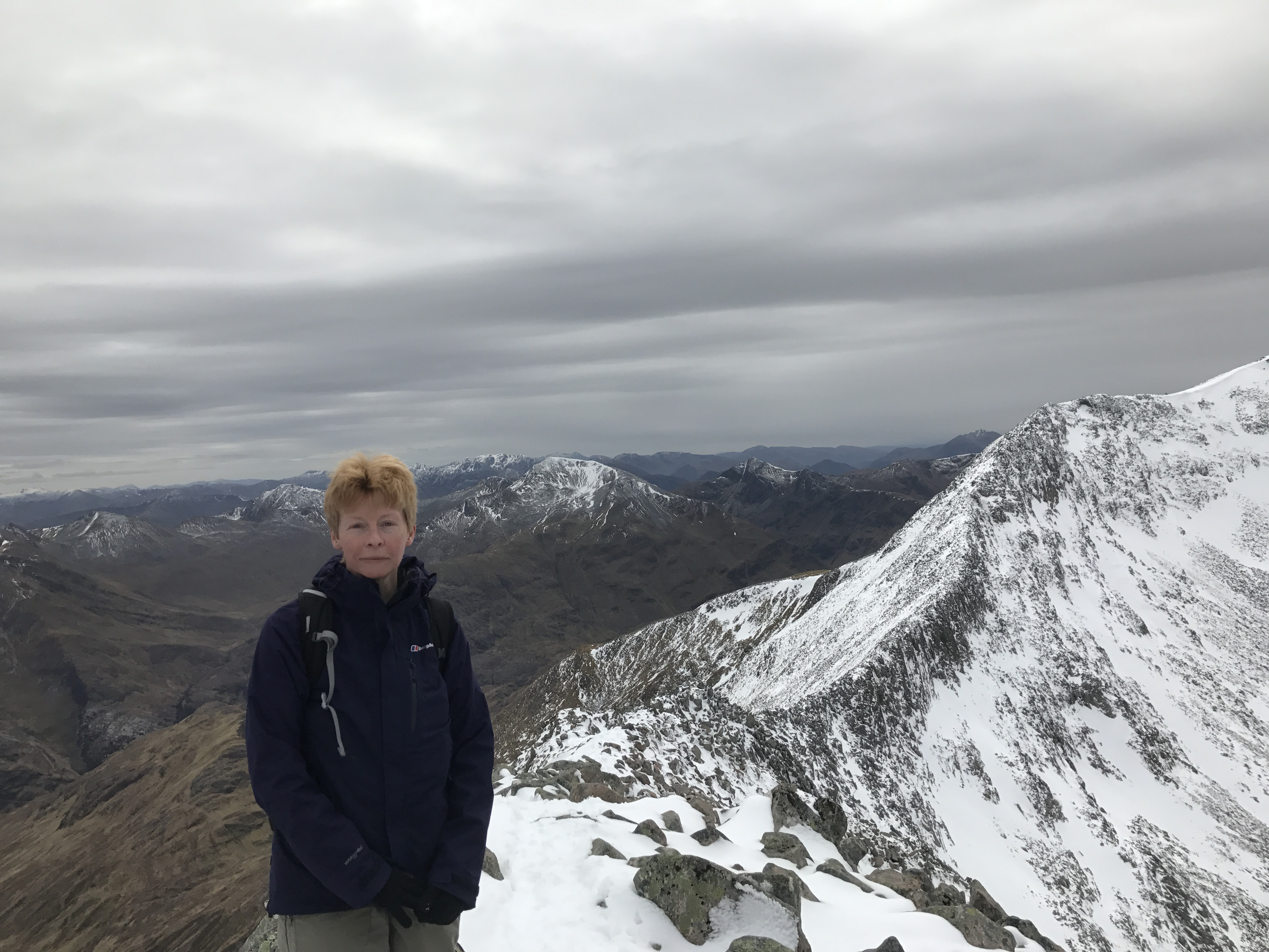
This is R and I at the summit.

A very, very enjoyable day – if a little scary at times. Yet again it taught us the importance of being properly equipped and having a good route planned out (with a backup GPS for eventualities). And even more than that, having respect for the Scottish mountains and the way the weather can turn in a flash.
We trudged back down by the tourist route – by 6pm we were in the car and home by 8pm. R refused dinner and took himself off for a well-earned whisky. We were in bed by 9:30pm – totally drained.
Having the day off today (well, perhaps a little trip up Cnoc Coinnich) and then Ben Lui on Thursday weather permitting.